Wednesday, October 30, 2013

Day 19: Lukla to Surke

Waking up we were excited to see clear blue skies and situation by 8:45am we had packed, eaten breakfast and secured our spot in the check in queue at Lukla Airport. We were booked to fly out via Tara Airways 16th flight of the day (over 40 flights were scheduled) which was supposed to be at 10:30am.

After hours of waiting, being told "come back in 45min" and watching countless angry/bewildered foreigners we were finally presented with our boarding pass and told to go through the security check post.

We got through the check post, handed in our luggage for the plane and headed to the departure lounge. After about 45min it became clear that the weather was not looking good. An hour or so into our lounge stop a man came in and told us that "all planes had turned back to Khatmandu but that the flights were not cancelled yet".

We knew what that meant... The long walk to Jiri was probably our only chance to catch Aaron's flight back to Australia on the 5th.

When flights are cancelled in Lukla you go into a "waiting list" this list goes behind the flights that were already scheduled on any given day. As there had already been two days of cancelled flights this meant that we would roughly be on flight number 50 out of Lukla (which could take anywhere up to 2 weeks to get to). The walk was inevitable.

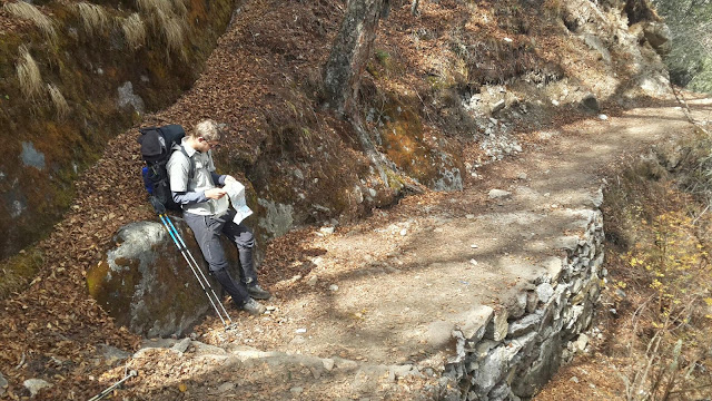
We got our baggage back, had some food, bought a map and then hit the road. We had decided to walk to Surke (just an hour or so from Lukla)  as we were running short on daylight.

Surke was a beautiful town and had a great big river running right through the middle of it. Huge vegetable gardens surrounded the town and immediately we could tell that there was going to be a lot less foreigners around over the next few days.

Day 18: Lukla Day 2

So there were supposed to be 35 flights out of Lukla today but only 8 planes got out before they closed the airport on account of bad weather. We couldn't get a flight. Have one booked for tomorrow morning at 10:30am so we will see what happens.

Loads of moody people in Lukla tonight. Chill. Enjoy the mountains guys. Cant do much about bad weather.

Day 17: Namchee Bazar to Lukla

Made the walk from Namchee to Lukla in a day (where we expected it to take 2). Weather soured towards the end of the day and looks like flights could be getting grounded. Not cool.

Sunday, October 27, 2013

Day 13: Thare to Gokyo

If we had known what the day was going to hold we probably would have planned things differently. We left Thare (4390m) at about 8am and made the long walk along the East side of the Dudh Koshi River Valley past dozens of yak stations and grazing villages. Steadily gaining altitude to about 4500m where we hit snow. Endless snow. It was beautiful, but it was deep so it took a lot of energy to get through.

We continued to climb to Dragnag (4700m) which we reached at about 2pm. Dragnag is located right where the Cho La pass comes down from the mountains (the pass we wanted to take after Everest Base Camp). The town is also right on the edge of the Ngozumba Glacier - which we were planning to cross. The Glacier is just over 1km wide so we figured it would only take an hour or so to cross (boy were we wrong).

After a quick cup of lemon tea at Dragnag we set off North along the lateral moraine of the glacier (the side). It took about an hour to get to a point where we could cut across the glacier and after climbing down into it we realized quickly that the traverse was sure to be rough.

Not only did we have to worry about falling rocks, underground rivers, ice, lakes and crevasses but there was also a 5ft dump of snow which literally covered everything.

We set across carefully following tracks and rock cairns but it wasn't long before we both took the first of many (many many many) falls into the deep snow. Each time it felt like large stores of our energy was being stolen away... It was hard to say the least.

We passed some amazing blue and steel grey lakes but the whole time we were kept on edge by the groaning and cracking of the glacier which did not let us get complacent at all. Rocks were constantly falling, we kept slipping into the snow and all the while the glacier moaned at us like a sleeping dragon.

We finally made it to the other side only to find that the moraine was more difficult to climb than anything we had faced yet. It was sharp and snowy and we were drained of all our energy. It took about 30 minutes to get up the 30m high moraine but when we reached the top we felt like we had achieved a great feat. In total it took just on 3 hours to get across.

A 30 minute walk found us at Gokyo and what a sight it was to behold. Surrounded by multiple 5000m and 6000m peaks Gokyo is located right on the edge of a beautiful blue lake named Dudh Pokhari. It really did look incredible to our tired eyes (and our energetic eyes the next morning) . Finding new energy we pretty much flew to the lodge nearest the lake and were amazed to hear that a double room would only cost us 100/- which is just on $1. Done.

We had a big meal and then headed to bed, exhausted after nearly 9 hours of trekking.

Day 15: Machhermo to Khumjung

Had a pretty solid trek again today, left Machhermo around 8am and worked our way to the end of the Dudh Koshi River Valley which was a fairly consistent descent. We crossed well below the snowline, passing waterfalls and streams and almost got to the Dudh Koshi River itself before the the trail shot back up the mountain again on a big hike up to Mong. We worked our way slowly to Khumjung, the largest town in the Everest Region where we planned to stay the night.

My knee was really starting to get painful towards the end and Khumjung could not have come sooner.

Day 14: Gokyo to Gokyo Peak to Machhermo

Woke up feeling great after a good long sleep. We had a nice breakfast at our lodge (where the view of the lake was incredible), packed a day bag and headed up Gokyo Peak (5360m). Gokyo Peak (or Gokyo Ri) is a small mountain located just beside the town of Gokyo and is famous for its great views of Everest, Nuptse, Cho Oyu and several other key peaks in the Himalayas (not to mention great views of Gokyo and it's lake).

The walk up was longer and harder than the trek up Kala Pattar, took us around 2 and a half hours to reach the summit. The view was magnificent and we spent about 45 minutes up there just soaking it all in.

We quickly descended using a modified glissading method (standing and using our trekking poles like ski poles to stabilise and push ourselves down the snowy slope). It was a lot of fun and we reached the bottom in around 30 minutes.

Once down we had lunch and then made a decision to depart the beautiful town of Gokyo as it was quite empty and we had exhausted all the available activities (tracks to nearby lakes were still snowed shut). The Renjo La was still very dangerous so we decided to head back down the West side of the Dudh Koshi River Valley towards Namchee Bazaar.

We left Gokyo about 2pm and 3 hours later we were in Machhermo about 10km down the valley. It was a nice snowy walk (cold and a little dark) along the glacier and then when that ended along the Dudh Koshi. The last 2 or 3 km was in thick mud which made us pretty dirty but thankfully we were wearing our gaiters on account of the snow so at least we mostly stayed clean.

Machhermo is a nice little town mostly made up of hotels and tea houses for trekkers like us and is situated in a snowy valley on the edge of a small stream. We got a nice room for 200/- per night and made our way to the restaurant for our nightly game of Yanif (an Israeli card game). While there I had a pretty large argument with a Nepali guide who was trying to cheat a German couple that we had met. The guide was quite taken back when I started correcting him in Hindi and pretty soon our argument caught the attention of a bunch of other Nepali men who upon hearing what I was saying (and the conviction I was saying it with) decided that they should steer clear. No win for you today my Nepalese friend.

Day 12: Pangboche to Thare

Put in another massive effort today and travelled all the way to Thare. Possibly the hardest stage of our trip since the walk into Namchee. The weather was beautiful but there was so much ascending and descending (hard on the knees) which caused it to be quite a difficult trek.

We left Pangboche at about 8am and got into Thare just before 3:30pm. A solid 7.5 hours of trekking. Again our lodge owner was surprised to hear that we had come so far. The path we choose to travel to Gokyo is not often used by foreigners and as a result Thare only has one tea-house (the only building in the town).

The walk was beautiful, we travelled at a very high altitude most of the way and passed around 6-8 beautiful waterfalls, some ice caves, shepherd stations and also passed up above the snowline again. Passed by the big town of Phorse but didn't stop to check it out. Some of the buildings along the way were incredibly beautiful, stone walls and stone slate roofs, they really looked like something out of a fairytale.

We stopped at 2:30pm for lunch at Thore before continuing on for 30 minutes to Thare, where we got a room for 250/- per night. These two towns were marked incorrectly on our map which led to some confusion. The lodge in Thare has no power and there is only 3 rooms (separated by 5mm plywood sheets). Pillows are hessian bags stuffed with plastic bags and then covered with a pillow case and when I went to open the window the whole frame came out in my hands. Looks to be a cold one tonight, but at least we are indoors.

Day 11: Gorak Shep to Pangboche

Woke up early feeling great after my best nights sleep since Namchee. Our room was still incredibly cold, around -10 Celsius, but I think I had finally acclimatised to the 5140m of Gorak Shep.

We hit the road with a plan to get at least as far as Pheriche (4240m) on our decent down the valley. Our plan is to head up the Dudh Koshi River to Gokyo within the next 5 days. We travelled really well (fast) and got to Pheriche by 2pm so we had lunch then continued walking till we got to Pangboche (3930m). In total we descended over 1200m in about 6 hours. We would have continued further but it was starting to get dark and we were unsure about accommodation at Phorse. The lodge owners at Pangboche were  very impressed with our trek as most people would do this in 2-3 days.

The walk was beautiful,  we started well above the snowline, followed the Khumbu Glacier all the way down to its end near Dughla where we crossed the terminal moraine and then headed through a beautiful riverbed which led down through the snow line to Pheriche. After this we had a small ascent up to the Pheriche Pass before we continued down the valley to Pangboche. Trees suddenly appeared out of nowhere and we realised that it had been a few days since we had seen anything green at all. Passed some paintings on a rock face that were pretty interesting, possibly done by monks as they appeared Buddhist in nature. Got held up by groups of yaks all the way but it was nice to have the change of pace.

After our horrible accommodation in Gorak Shep we were amazed with our rooms in Pangboche. Not only were they clean, warm, painted and spacious, they also had windows that opened out to incredible views of the mountains (our window in our room at Gorak Shep was basically buried in snow).

We were able to sun out our clothes a little, change, have a good wash and even dry our socks! Its been a good day!!!

Tuesday, October 22, 2013

Day 10: Gorak Shep to Everest Base Camp to Gorak Shep

The trek to Everest Base Camp was no where near as lame or boring as we were led to believe. It was not an anticlimax in any way. Perhaps this was due to the heavy dump of snow that had left everything in brilliant white. The trek there took nearly 2.5 hours and travelled along the lateral moraine of the Khumbu Glacier.

Just as we were about to cross the glacier we looked up and realized that we had to cross a section of track about 100m long that passed under some incredibly overhung rocks about 30m above us. Right before our eyes rocks were tumbling down the slope, one of them was as big as a television. Some of the rocks at the top were the size of small houses and though they may well have been secure we had no way of knowing. We plucked up the courage and dashed through this "kill zone" as fast as our altitude effected lungs could take us... Thankfully making it through with no injury (or death).

We then set across the glacier taking time to look at the beautiful lakes and deep crevasses that were scattered along it and then we reached the prayer flags that symbolised "Everest Base Camp". Many people don't know this but there are actually two base camps, one is for the day trekkers and one is for the actual expedition teams that are climbing Everest.

On account of the heavy snow all expeditions had pulled out of the climbers camp except one, the Korean Expedition. They would not let the snow defeat them and were determined to make a summit attempt. As there was no one around to object we trekked the extra 300m and took some photos around the real Base Camp and the awesome views of the Khumbu Icefall before heading for home.

We again had to cross the "kill zone" which we again managed without incident. The walk back to Gorak Shep was nice and easy and took around 1 hour.

Anyone who comes up this far and skips Base Camp is making a huge mistake in my opinion, it was one of my favourite things so far.